Addressing a Global Pandemic with Geospatial Data


When trying to stop a disease that’s causing a global public health crisis, you need to quickly answer a few questions to obtain a baseline understanding of the situation:
- Where do people live?
- How can medical workers reach them?
- What facilities are currently available?
- Where can we build new facilities that can serve those most in need?
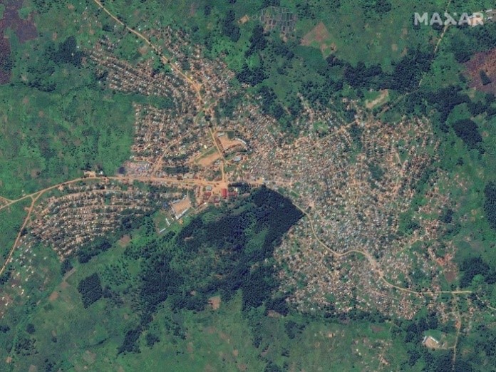
Answering these questions looks different from country to country. While some countries have robust data streams with detailed maps, others haven’t had a census in several decades. Maxar’s imagery provides a consistent stream of mission-critical data – whether you're in the United States, South Korea or South Africa.
Where do people live? How can medical workers reach them?
Maxar creates visually consistent satellite imagery basemaps, which are optimized for machine learning algorithms to extract vectors like building footprints and roads across vast areas. This leads to the discovery of previously unmapped villages, like during the 2018 Democratic Republic of the Congo (DRC) Ebola outbreak. Maxar currently supports a Humanitarian OpenStreetMap Team (HOT) mapping project for the ongoing Ebola response in DRC. These health surveillance efforts evolve as technology changes, providing a common operating picture for public health officials to use when coordinating their efforts, whether it’s for COVID-19 or food security, among other uses.
What facilities are currently available?
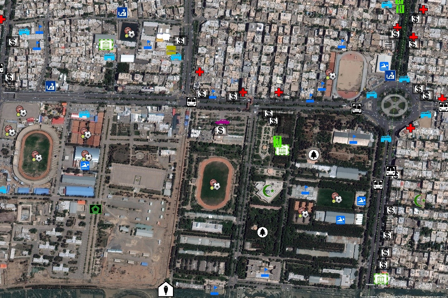
There’s little to no data on health infrastructure and services in some countries, which is necessary information for planning and executing pandemic responses. By pairing satellite imagery with other geospatial datasets, more insight can be gained.
Human Landscape is a comprehensive geo-database detailing human geography like medical facility types and locations, water infrastructure locations and other data layers that are useful for pandemic responses. These datasets help response teams figure out what’s available in communities and what needs have to be addressed.
Where can we build new facilities that can serve those most in need?
Combining Maxar’s satellite imagery with datasets like GRID3’s population and settlement mapping layers unlocks insights across a wider range of use cases, answering questions like:
- What kind of access do vulnerable populations have to health clinics?
- How many people does each clinic serve?
- How many people live too far from existing facilities?
The benefit is response teams can complete this analysis before deploying into the field, saving lives, resources and time. When a virus is spreading quickly, informed decisions based on facts, not fear, are necessary on the timeline of hours and days, not months and years as was required with previous, manual mapping methods.
To learn more about infectious disease response planning using Maxar imagery and data, please watch this webinar.

Want to Hear More from Dr. Scott?